
 De
De 

-
-
-
-
Main Menu
-
-
-
-
-
-
-
-
-
-
-
-
-
-
-
-
-
-
-
-
-
-
-
-
-
-
-
-
-
-
-
-
-
-
-
-
-
-
-
-
Main Menu
Create custom and edit existing menus using context menu of element.
All menus used in the program are presented in the tree list.
The commands to create and edit menus are called from the context menu. Composition of the context menu commands depends on the selected tree object.
1. To open the Create menu context menu, select the top line of the Main menu tree (or right click in the list window). If you select a certain menu and use the Insert menu context menu command, a new menu will be located directly before the selected one.
2. Fill fields in a Create menu dialog:
|
UID |
Element identifier in the program. |
|
Display name |
Displayed name on the screen. |
3. Press OK.
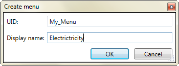
New menu appears in the end of the list of elements. Move them using drag and drop.
Create elements of menu
1. Select the desired menu in the list of menus.
2. Select one of the items:
· Add menu item
· Add submenu
· Add separator
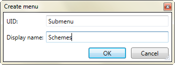
Add submenu
1. Select Add submenu.
2. Fill fields in the Create menu dialog, press OK.
Add menu item
Menu item is a command in the menu list.
1. Select Add menu item.
2. Fill fields in a Create menu item dialog.
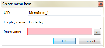
3. Click the  button to add the command.
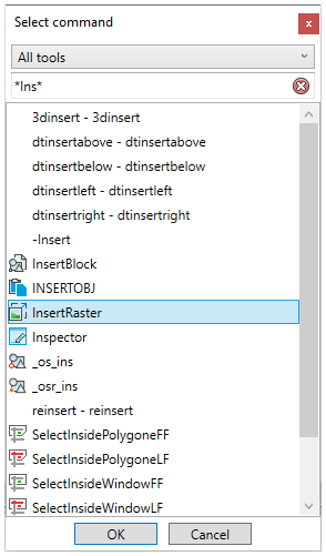
4. Select the desired command in a Select command dialog box. Press OK
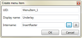
 button clears the field.
Add separator
Separator looks like a line in menu, submenu, toolbar, statusbar. Used to split commands by groups.
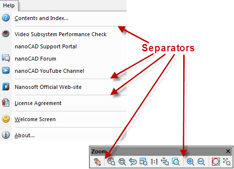
1. Select the menu bar to insert separator above.
2. Select Add separator in the context menu
Add commands into menu and submenu
1. Select the command from the right list.
2. Drag it and drop to menu at the left part of dialog.
Remove elements and menus
1. Select the desired element or menu.
2. Use Delete command in the context menu.