De
De  Es
Es  Fr
Fr  Pt
Pt 

nanoCAD Platform Help
-
-
-
-
-
-
-
-
-
-
-
-
-
-
-
-
-
-
-
-
-
-
-
-
-
-
-
-
-
-
-
-
-
-
-
-
-
-
-
-
-
-
-
-
-
-
Save as Geounderlay
Save as Geounderlay
 Ribbon: Topoplan – Measurements Archive >
  Save as Geounderlay
Menu: Topoplan – Measurements Archive >  Save as Geounderlay
 Toolbar: Measurements Archive > Save as Geounderlay
 Command line: NG_GEOUNDERLAY_SAVE
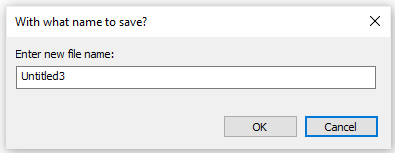
Saving a current file to the geounderlays archive.
Specify the file name (the name of the current one is specified by default).
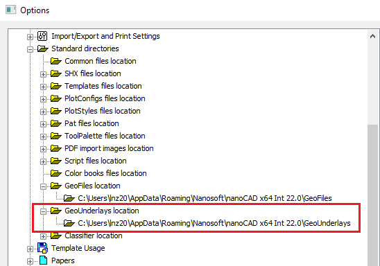
The file is saved to the Geounderlays folder.
The path to the folder is determined in the Standard directories section of the Options dialog.