
 De
De  Es
Es  Fr
Fr  Pt
Pt 

-
-
-
-
-
-
-
-
-
-
-
-
-
-
-
-
-
-
-
-
-
-
-
-
-
-
-
-
-
-
-
-
-
-
-
-
-
-
-
-
Recalculation of Coordinates
-
-
-
-
-
-
-
-
-
-
-
-
-
-
-
Recalculation of Coordinates
 Ribbon: Topoplan – Settings >
  Recalculation of Coordinates
Menu: Topoplan – Settings >  Recalculation of Coordinates
Toolbar: Topoplan Settings > Recalculation of Coordinates
 Command line: NG_REPROJECTION
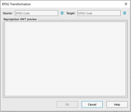
The command recalculates geocoordinates of topoplan objects to another system using EPSG codes.
After running the command, an empty dialog box will open, in which you can enter the number of the source and target SRC or select it by clicking the  button.
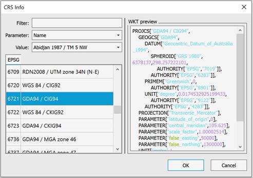
In the dialog box that appears, select the number of coordinate system according to the EPGS classification, based on the list on the left side of the window. You can use the search filters. When finished, click OK.
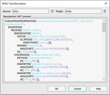
Information about the transformation will appear in the preview window. Click OK to confirm the transformation.
The list of coordinate systems for conversion also includes user-created coordinate systems (the Create Coordinate System command). The file with user-created coordinate systems is located at – C:\Users\User_name\AppData\Roaming\Nanosoft AS\nanoCAD x64 26.0\imppointslib\geoids\other.extra.
|
|
Note |
|
The NG_REPROJECTION command works only with Topoplan and is not intended for recalculation of Point Clouds. |
