-
-
-
-
-
-
-
-
-
-
-
-
-
-
-
-
-
-
-
-
-
-
-
-
-
-
-
-
-
-
-
-
-
-
-
-
-
-
-
-
-
-
Import Elevation Grid
-
-
-
-
-
-
-
-
-
-
-
Import Elevation Grid
 Ribbon: Topoplan – Create TIN >
  Import elevation grid
 Menu: Ground – Creating TIN >
  Import elevation grid
 Toolbar: Creating TIN >
  Import elevation grid
 Command line: NG_IMPORT_ELEVATIONGRID
To create surfaces in the module it is possible to load elevation grid files in PGM, GRD, ASC, DEM formats. As a result of the import, a surface is created in the form of a Mesh object.
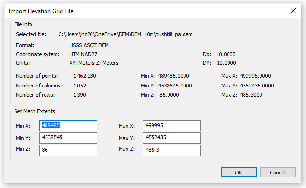
After starting the command, a standard file selection dialog box will open. It is necessary to specify the file and click OK. The import dialog will open:

The command options are set in the Properties bar.
Options:
|
Split mesh for optimization |
If this option is enabled, for more convenient work the mesh will be split into several smaller objects. It is recommended to enable this option. |
|
Convert to CS |
If the elevation matrix was created in WGS-84 system, them its conversion is required to display in a drawing’s rectangular coordinate system. Possible variants: UTM (Universal Transverse Mercator), CK-42, CK-95. Also, it is possible Do not convert the elevation matrix, but it is recommended not to use this option. |
In case the command is performed successfully, the message will appear:
Import evaluation grid done!


 De
De  Es
Es  Fr
Fr  Pt
Pt 
