De
De  Es
Es  Fr
Fr  Pt
Pt 

-
-
-
-
-
-
-
-
-
-
-
-
-
-
-
-
-
-
-
-
-
-
-
-
-
-
-
-
-
-
-
-
-
-
-
-
-
-
-
-
-
-
Create Geopoints/Blocks Manually
-
-
-
-
-
-
-
-
-
-
-
-
-
Create Geopoints/Blocks Manually
Ceopoints/Blocks Manually
 Ribbon: Topoplan – Geopoints >
  Create Geopoints/Blocks Manually
 Menu: Topoplan – Geopoints >
  Create Geopoints/Blocks Manually
Toolbar: Geopoints > Create Geopoints/Blocks Manually
 Command line: NG_CREATE_POINTS
The command creates geopoints or blocks with the location of the point in the drawing, description and mark.
Command prompt:
|
Select point type or [Blocks/COGOPoints]: |
Select the type of the object to be created. |
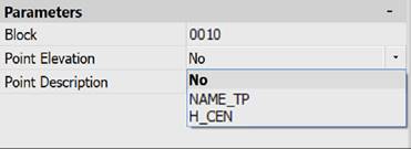
For blocks:
Blocks can only be added to a drawing that contains blocks with attributes. In the Properties bar, you can specify the block name, elevation, or point description. The point elevation and description are selected from the attributes of the selected block.
|
Apply changes [Yes/No/Save/saveDefault] <Yes>: |
Yes – the command will be performed taking into account the changes in settings made by the user in the current session of the command. No – the command will be performed with the settings that were displayed immediately after the command was launched. Save – save the settings to the document. saveDefault – save the settings to the registry. |
|
Specify the location for the new point: |
Specify the location of the point in the drawing field, or enter the coordinates of the point. |
For geopoints:
|
Specify the location for the new point: |
Specify the point location in the drawing field or enter the point coordinates. |
|
Enter a description of the point <.>: |
Enter the point description. |
|
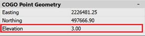
Specify the elevation of the point <.>: |
Enter the point elevation mark.
|
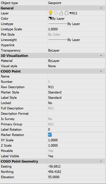
These and other parameters of the created point can be later edited using the Properties bar. For example, you can separately set the rotation angles for a marker and a label. If label and marker styles are missing, then geopoints will be created with the standard style.