-
-
-
-
-
-
-
-
-
-
-
-
-
-
-
-
-
-
-
-
-
-
-
-
-
-
-
-
-
-
-
-
-
-
-
-
-
-
-
-
-
-
-
-
Correction of Zero Elevation
-
-
-
-
-
-
-
-
-
Correction of Zero Elevation
 Ribbon: Topoplan – Relief >
  Correction of Zero Elevation
 Menu: Ground – Elevation >
  Correction of Zero Elevation
 Toolbar: Elevation >
  Correction of Zero Elevation
 Command line: NG_ADJUST_ZERO_ELEVATIONS
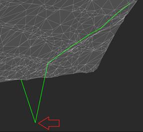
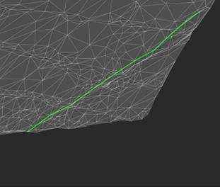
The command changes the elevations (Z coordinate) of a 3D polyline, aligning them in the range from one valid elevation to another using the linear interpolation method.
When running the command, specify 3d polyline in the drawing and press Enter. The nodes the Z coordinates of which had 0 value, will be corrected.
note: Zero values of Z coordinates of endpoints of 3d polylines will be corrected for non-zero values of Z coordinates of adjacent points.
|
Node of 3D polyline that needs correction |
3D polyline after correcting elevation |
|
|
|


 De
De  Es
Es  Fr
Fr  Pt
Pt 


