De
De  Es
Es  Fr
Fr  Pt
Pt 

-
-
-
-
-
-
-
-
-
-
-
-
-
-
-
-
-
-
-
-
-
-
-
-
-
-
-
-
-
-
-
-
-
Recalculation of Point Cloud Coordinates by EPSG
-
-
-
-
-
-
-
-
-
-
-
-
-
Recalculation of Point Cloud Coordinates by EPSG
 Ribbon: Point Clouds – Point Cloud >
  Recalculation of Point Cloud Coordinates by EPSG
Menu: Point Clouds > Recalculation of point cloud coordinates by EPSG
Toolbar: Point cloud > Recalculation of Point Cloud Coordinates by EPSG
 Command line: NPC_EPSG_REPROJECTION
If the loaded point cloud has geocoordinates, the command allows you to recalculate them to another system using EPGS codes. This creates a new cloud for the target coordinate system.
After running the command, an empty dialog box will open with the number of the source CS.
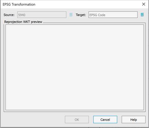
You can select the target CS by clicking the  button.
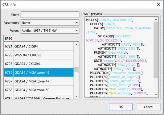
In the dialog box that appears, select the target coordinate system number according to the EPGS classification, based on the information in the left pane. You can quickly find the desired number using the filter, parameters, and value. After selecting the coordinate system, click OK.
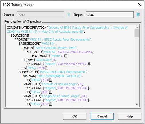
Information on the selected target geocoordinate system will appear in the preview window. Click OK to confirm the transformation.
|
|
Note |
|
The Recalculation of point cloud coordinates and Recalculation of point cloud coordinates by EPSG commands are mutually exclusive. Use one of them to convert geocoordinates of a cloud. |

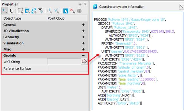
Information about the current geocoordinate system of the cloud can be viewed by clicking the button from the Properties bar (Geoinfo bar) or from the Coordinate system information dialog.