De
De  Es
Es  Fr
Fr  Pt
Pt 

nanoCAD 3DScan Help
-
-
-
-
-
-
-
-
-
-
-
-
Aerial Laser Scanning
-
-
-
-
-
-
-
-
-
-
-
Aerial Laser Scanning
 Ribbon: Point Clouds > Aerial Laser Scanning >
  Adjust point clouds
Menu: Point Clouds > ALS >  Adjust point clouds
Toolbar: ALS >  Adjust point clouds
 Command line: PC_CLOUDS_ADJUST
 This is a trial version. The command is currently in a testing mode and may be changed or removed in future releases.
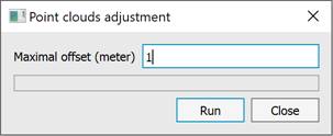
This command is used to eliminate the relative displacement between point clouds. For each point cloud, transformation parameters are calculated – translation, rotation – that reduce the discrepancies between cloud points. To run the command, specify the maximum discrepancy between the clouds in meters.