

 De
De  Es
Es  Fr
Fr  Pt
Pt 

nanoCAD 3DScan Features
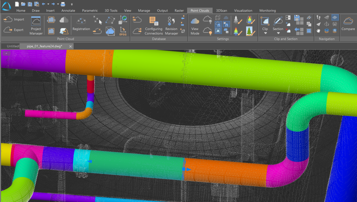
Searching for planes and pipes in the cloud
Tools for searching pipes and planes in a point cloud based on specific parameters
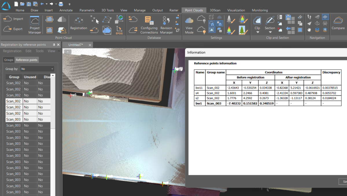
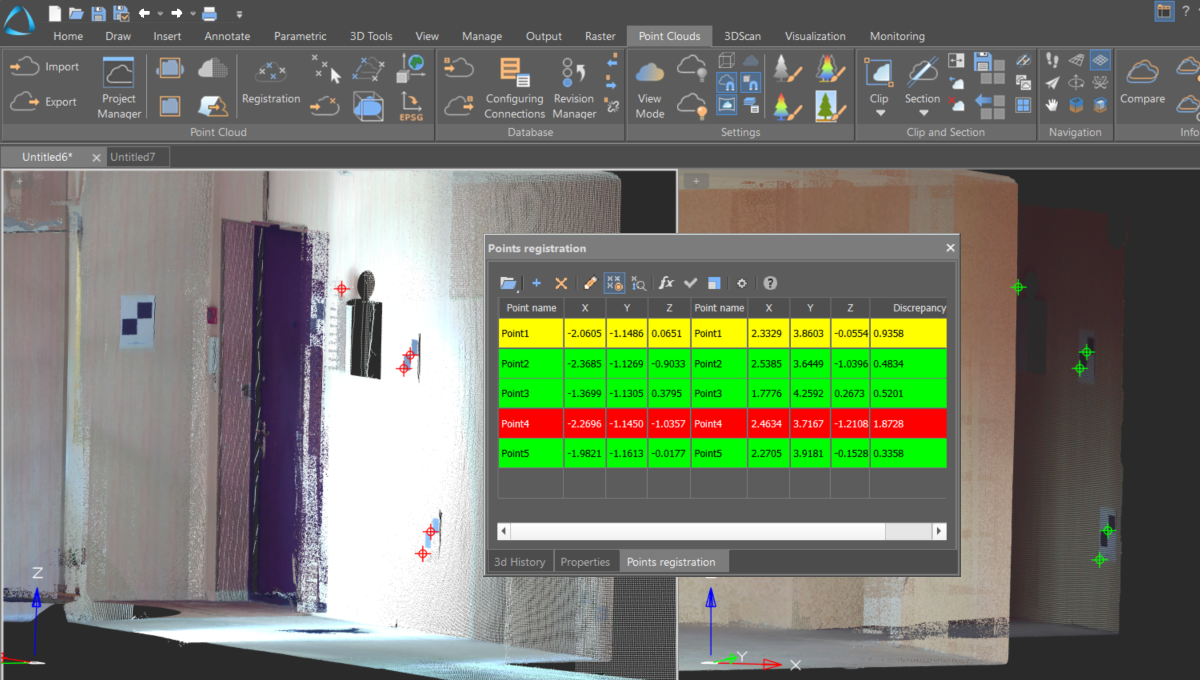
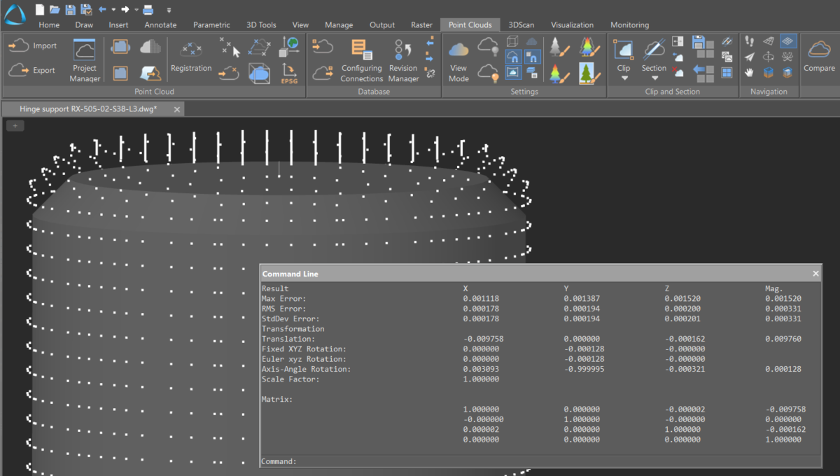
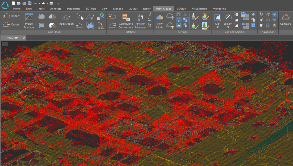
Quality assurance of registration and error control
Monitoring deviations at each point enables assessment of the registration quality. Reference points with significant discrepancies can be excluded or their weights adjusted, followed by a repeat registration.
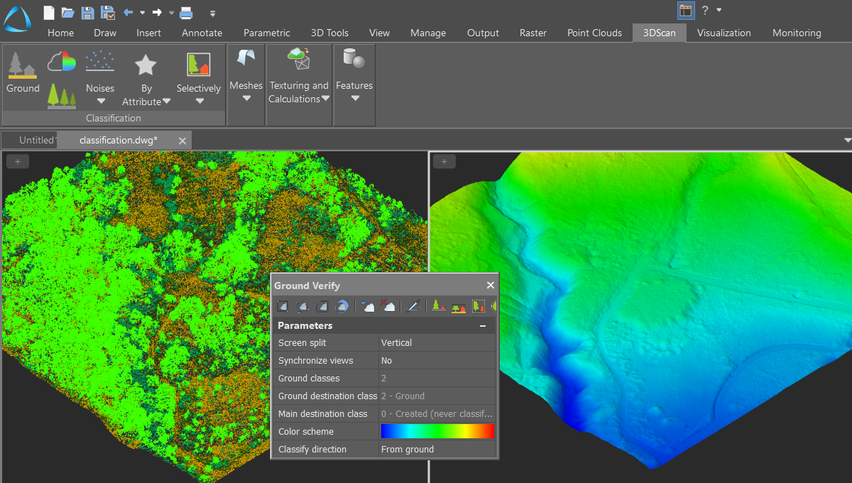
Ground classification and verification
An algorithm for automatic ground identification, complemented by a ground verification command that allows for manual refinement of automatically classified points.
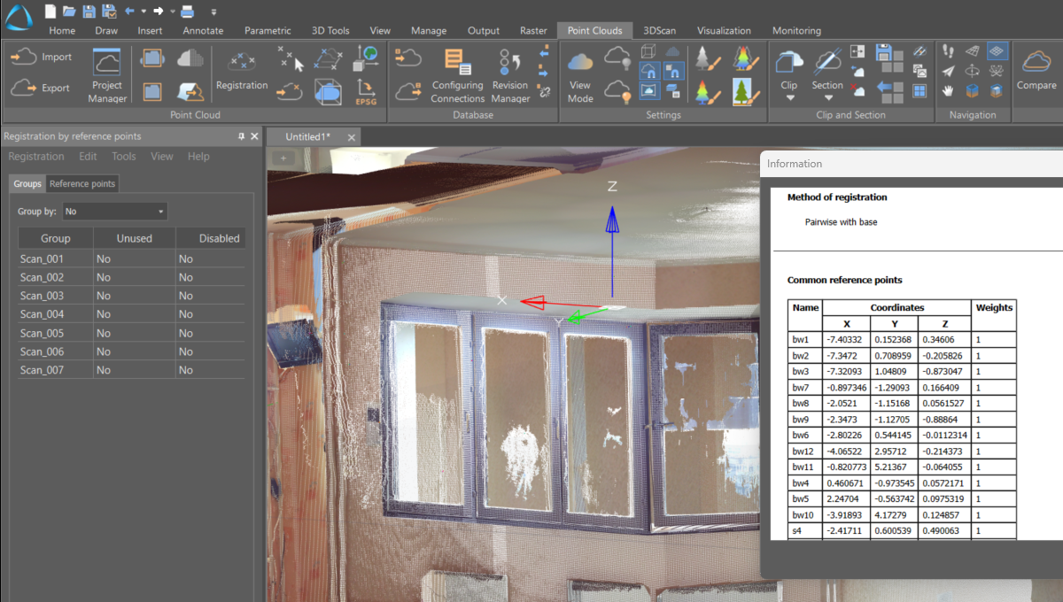
Registering clouds by reference points
Mutual orientation of multiple point clouds. Registration allows you to find transformation parameters for an arbitrary number of groups of reference points. Two methods are used: pairwise and iterative.
Creating a point cloud from a model
The tool transforms the specified model into a point cloud at a designated density.
Stitching scans by aligning pairs of corresponding points
The command enables manual registration of clouds by selecting pairs of corresponding points on the screen.
Combining a point cloud with a model
The command achieves precise alignment of a point cloud with a reference model when there is only a minimal offset.
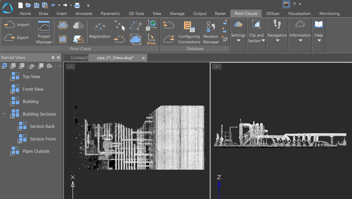
Named views
The command saves segments of the point cloud generated by clipping or sectioning tools.
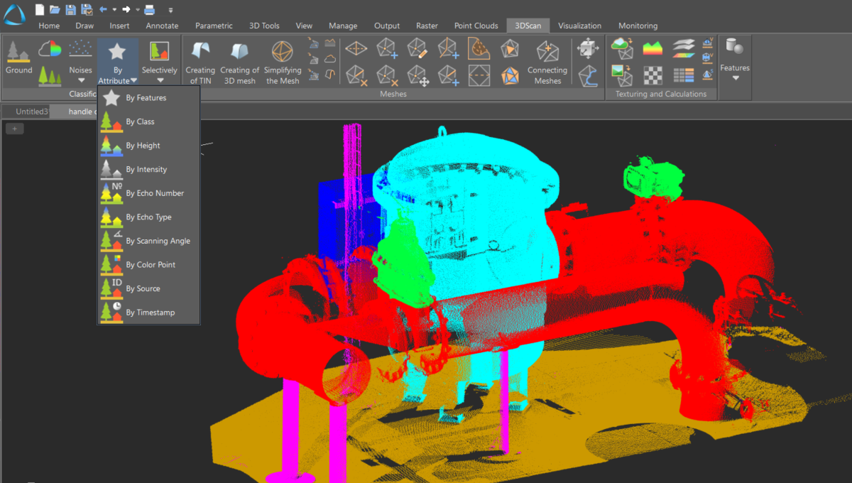
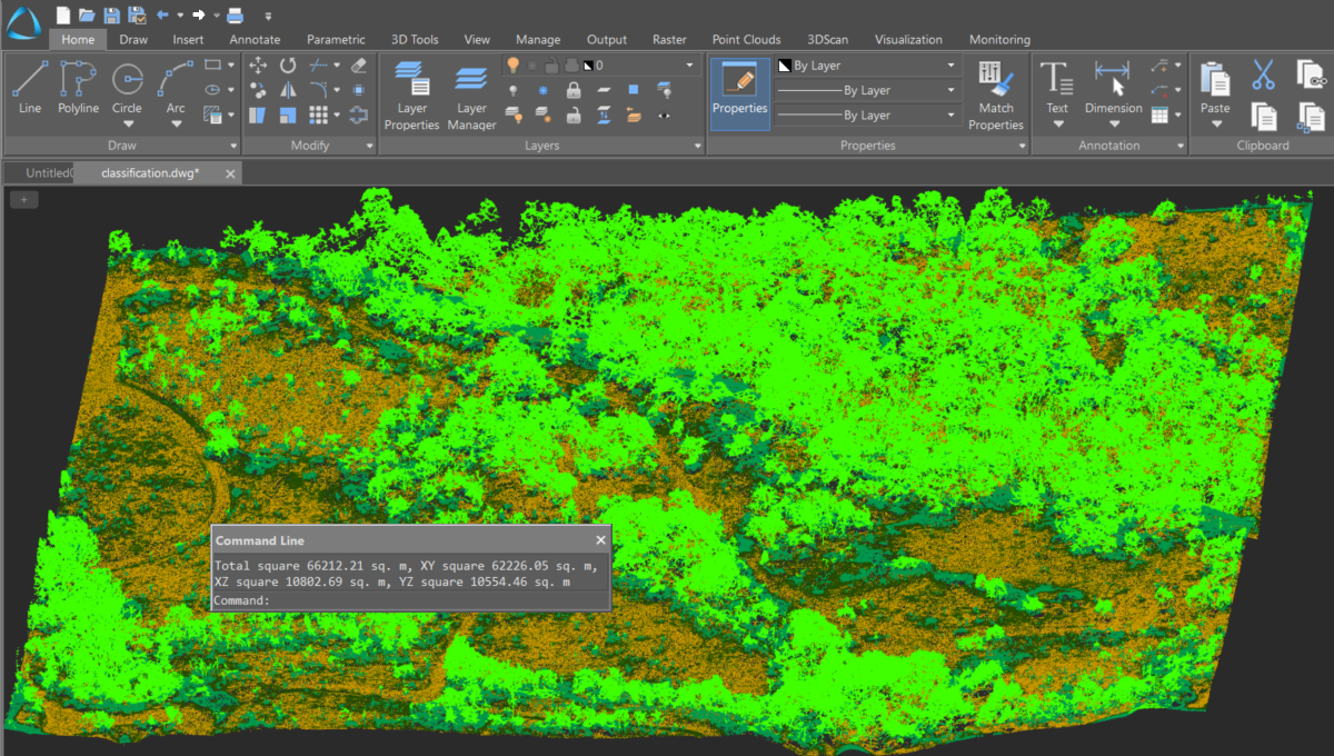
Classification of sections by attribute
A wide set of tools and parameters for automatic classification based on specified criteria.
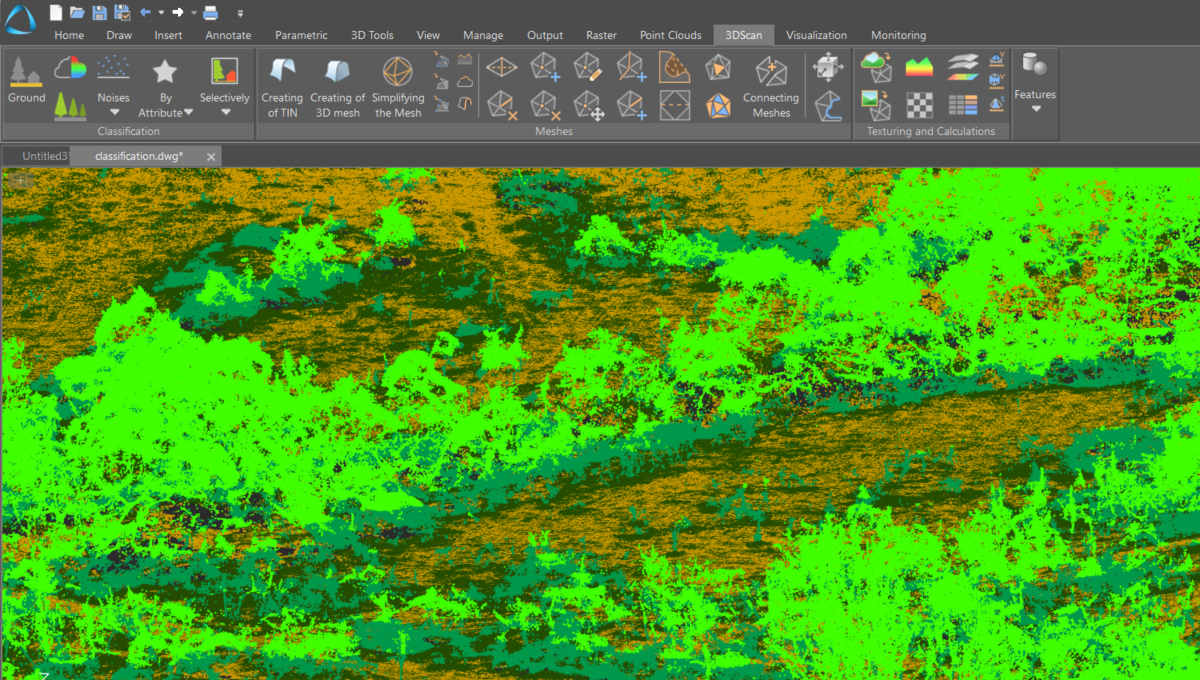
Classify Vegetation by Height
Classification of points within a specified elevation range relative to the ground surface. An option to classify various objects by elevation from the ground (such as structures, buildings, power line supports, etc.) is also possible.
Reducing the Point Cloud
The command reduces the number of points in the selected cloud, alleviating excess density that can significantly prolong the processing time of large clouds.
Data filtering
Setting up attribute (metadata) and point classes filters for imported files.
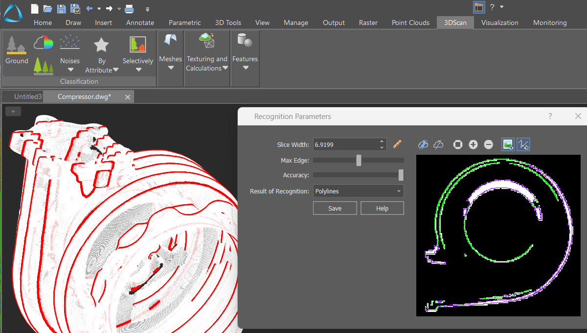
Layer-by-layer vectorization
Automatic construction of multiple sections of point clouds at specified intervals, followed by their vectorization and the generation of raster images.
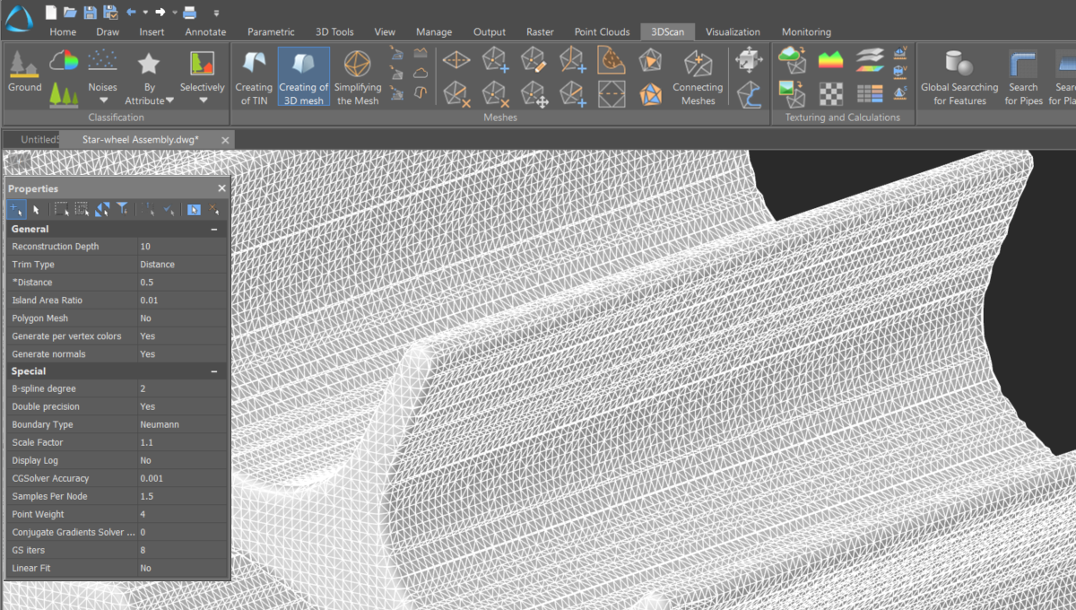
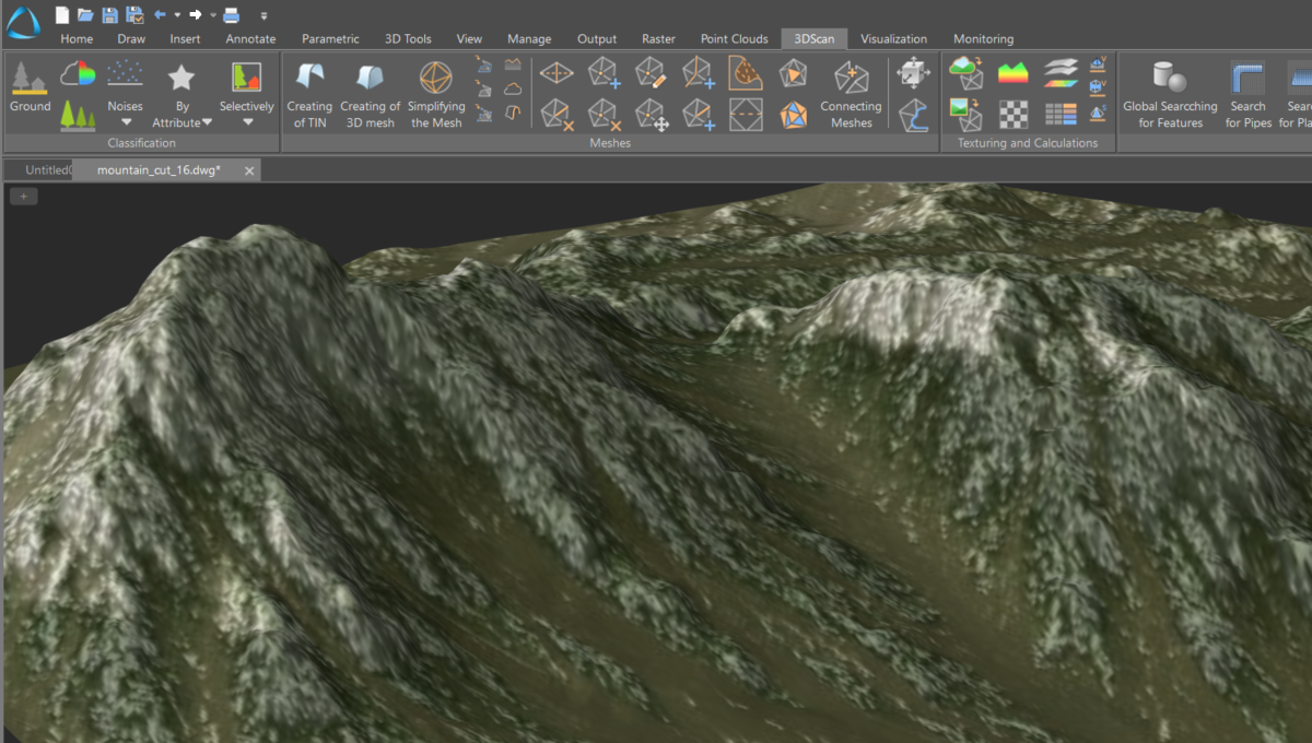
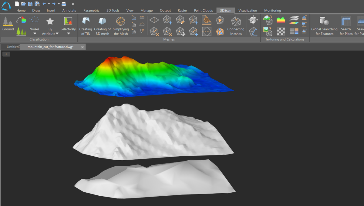
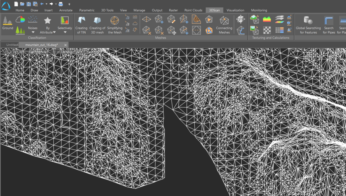
Creation of a 3D mesh
The command performs 3D triangulation of point clouds of volumetric objects by creating meshes. It can be used to triangulate buildings and other surface structures.
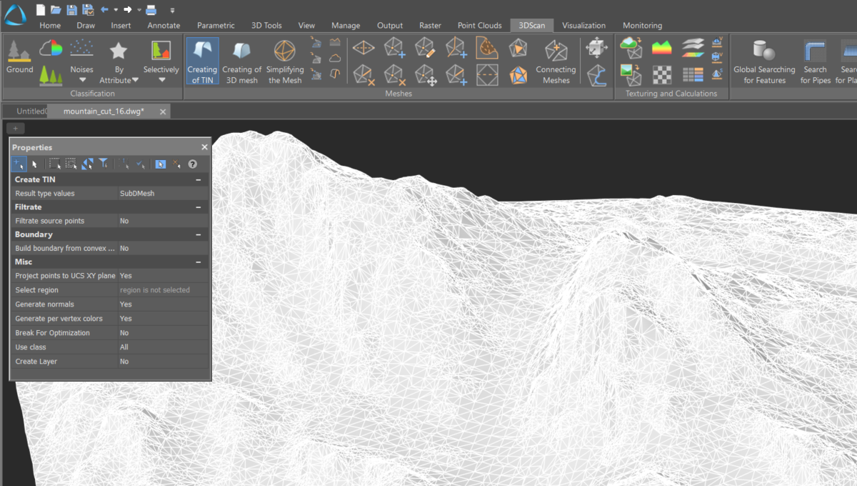
TIN Creation
The command creates an irregular triangulation mesh from a point cloud. The resulting mesh consists of edges that form non-overlapping triangles.
Creation and transfer of cross-sections
The command performs parallel translation of any section within the selected viewport, moving it a specified distance forward or backward.
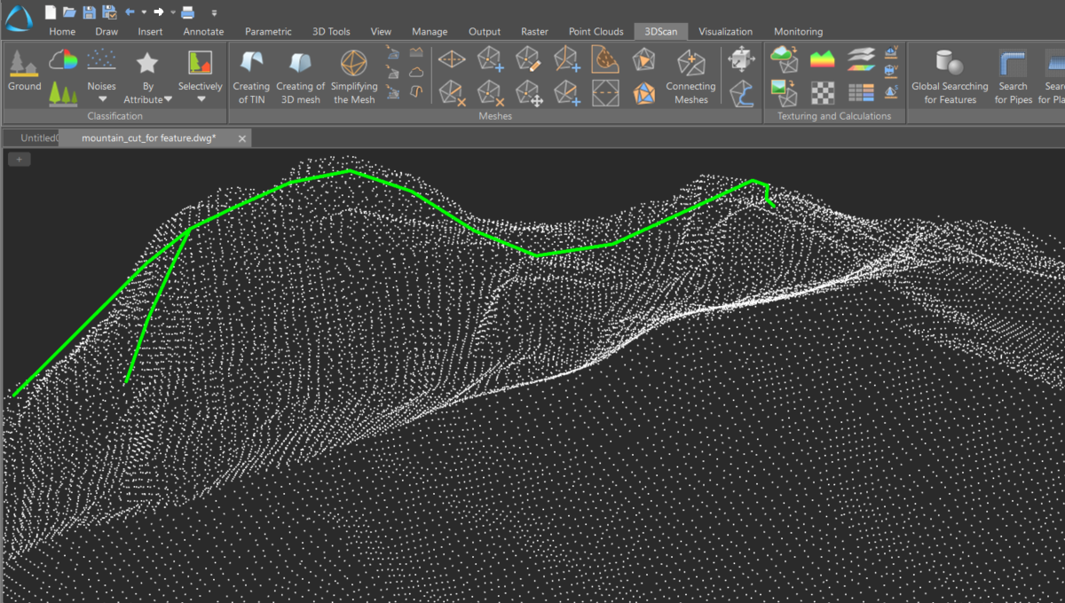
Searching for key lines
The command searches for key lines such as thalwegs, ridges, etc. It can search both within a point cloud and across a surface.
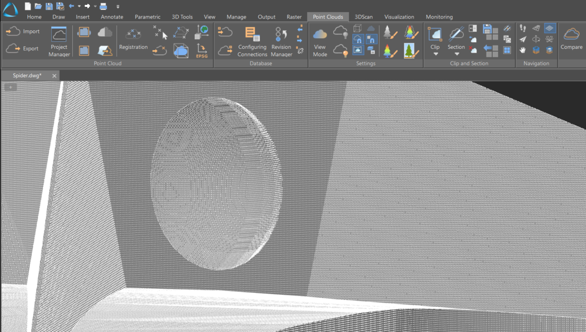
Fitting elementary shapes
A set of commands that creates objects (line, plane, sphere, cylinder) fitted into a point cloud or a section.
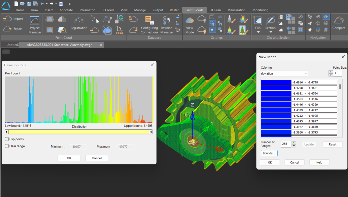
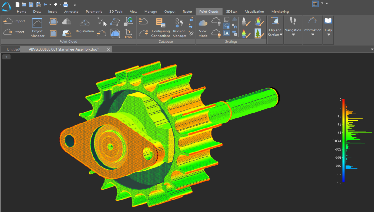
Displaying deviations
A display mode for viewing comparison results with the option to configure additional parameters.
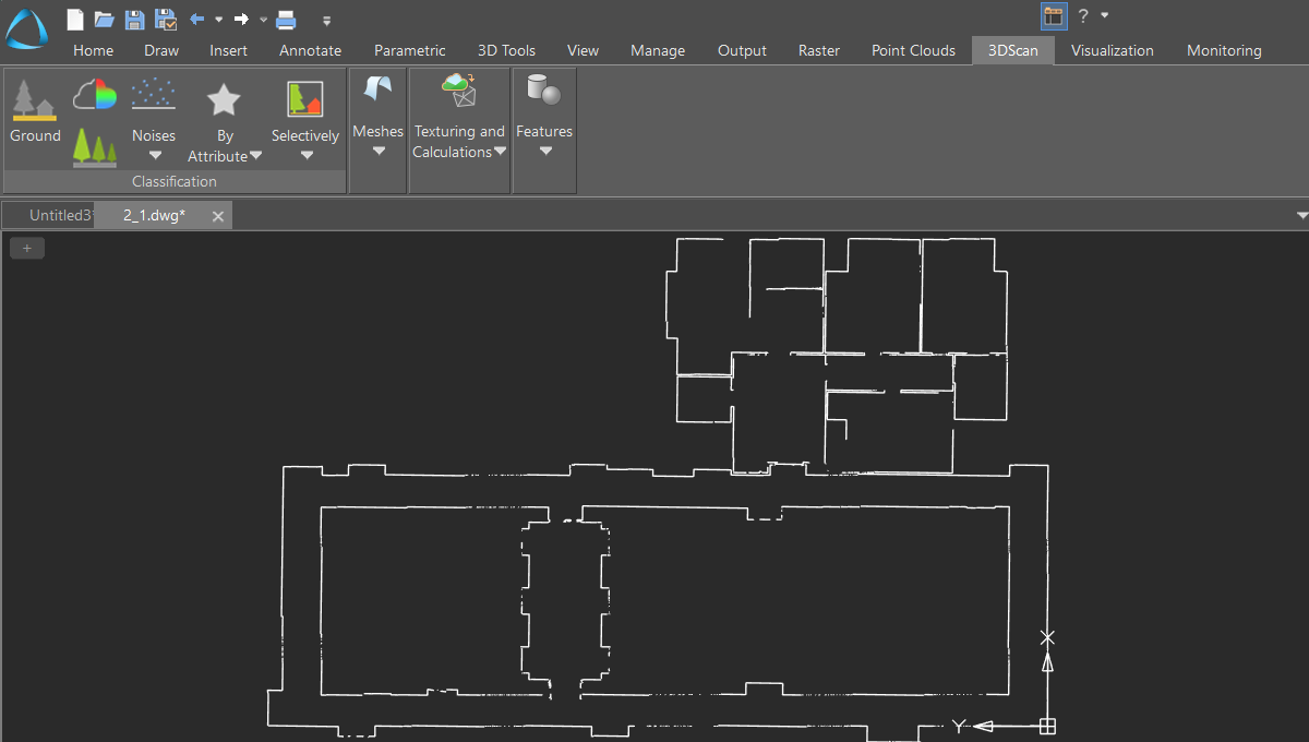
Floor plan construction
Creating a vector floor plan from point cloud data, which may include an external scan of a building and scans of its interiors.
Texture overlay
A set of commands that generates textured surfaces based on specified tasks and input data. These commands allow for the application of flat textures, textures from raster images, and textures from a texture atlas.
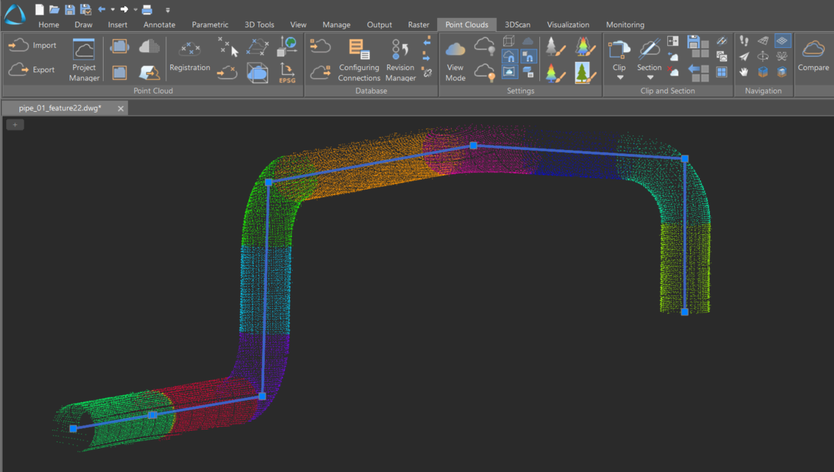
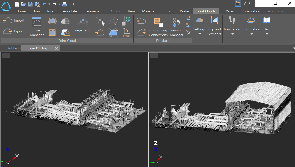
Pipeline route creation
Visualization and alignment of pipeline segment axes, constructing a unified route as a 3D polyline. It includes automatic calculation and identification of turning points.
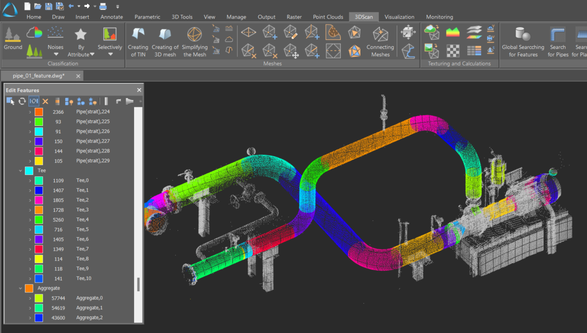
Creating objects by features
The command creates three-dimensional vector objects based on recognized geometry within a point cloud.
Surface difference calculation
The command allows for the calculation and creation of a differential surface between two other surfaces.
Mesh editing
A comprehensive suite of tools for editing constructed meshes, including contouring, slicing, classifying, simplifying, gap filling, and mesh cropping.

Global searching for features
The command searches for basic geometric shapes (plane, sphere, cylinder, cone, torus) within a point cloud.
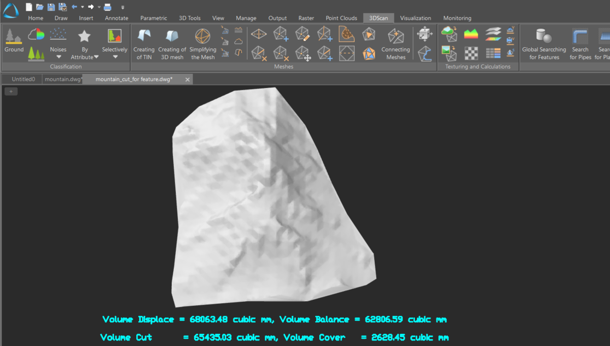
Volume calculation
A set of tools for calculating volumes between a model and a point cloud, within a contour, or between models. It computes the total volume, balance volume, and the amounts of material to be removed or added.
Area calculation
The command is designed to determine the area of a surface section. It calculates both the total area and the areas projected onto planes.
Point clouds comparison
The tool allows you to assess the degree of overlap between two point clouds or between a point cloud and a model.