Software
.svg) nanoCAD 3DScan
nanoCAD 3DScan
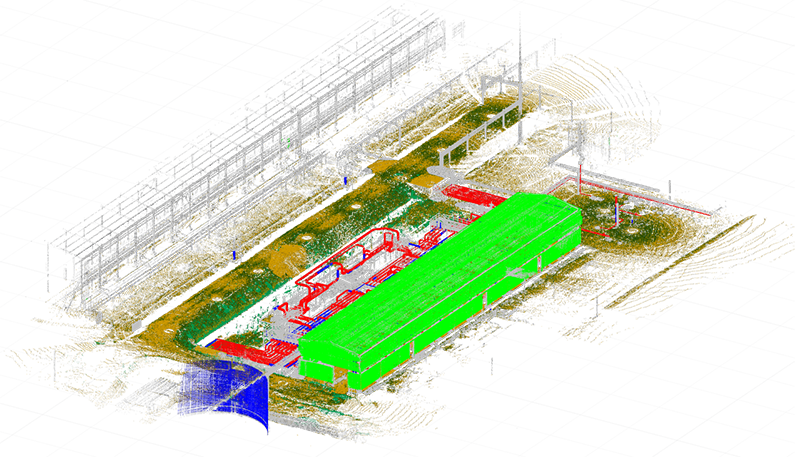
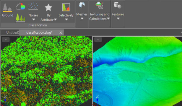
nanoCAD 3DScan is specialized software designed for processing 3D scanning data and tackling engineering and informational challenges across fields such as geodesy, mechanical engineering, construction, infrastructure, and metrological monitoring.
1-Year Subscription or 3 years
Commercial, Educational and Trial licenses are available. Where Applicable
Modeling
- Three-dimensional modeling, including simulation;
- Support for Building Information Modeling (BIM).
Design
- Construction and operation of engineering structures, buildings, and communications;
- Design of machines and mechanisms.
Monitoring
- Monitoring the technical condition of facilities, emergency situations, and environmental conditions;
- Inventory and automation of creating digital twins of industrial facilities.
Topography
- Creation of 2.5D drawings and plans, including topographical ones;
- Populating GIS systems.
Supervision
- Modeling transportation tasks;
- Collision detection;
- Author's supervision.
Measurements
- Conducting operational calculations and measurements.
What you get
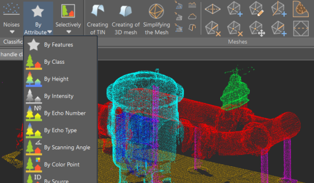
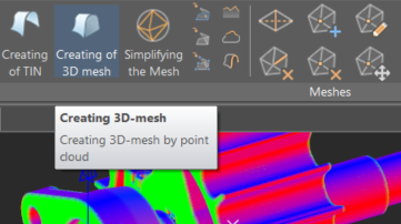
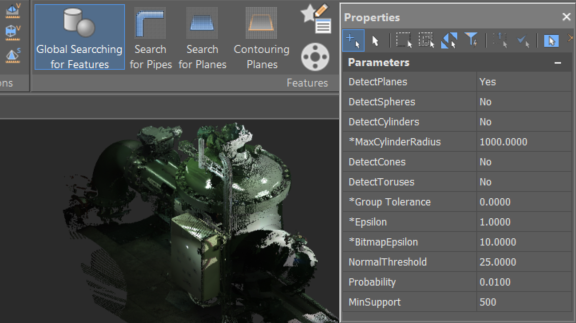
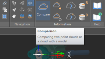
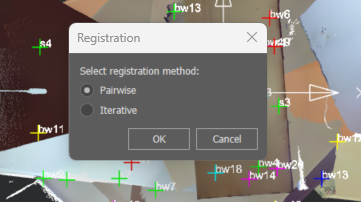
Over 150 commands that implement the main stages of 3D scanning data processing
The 3DScan tools are based on Nanosoft AS's unique proprietary technologies and allow for the processing of 3D scanning data with the highest levels of performance and reliability. By using these and other 3DScan tools, you can build efficient data processing pipelines for 3D scanning, ultimately obtaining the information you need about real-world objects.
And Also
Flexible Licensing
Workstation License: Ideal if you're using a single device. This option suits individual users best.
Network License: Perfect for businesses where multiple team members need access to the software during the design process.
Network License: Perfect for businesses where multiple team members need access to the software during the design process.
Subscribe options
1-Year Subscription: Perfect for short-term projects or initial trials.
3-Year Subscription: Offers a perpetual license with full support and upgrades for three years.
Free 30-Day Trial: Test the software with a full month of free access.
3-Year Subscription: Offers a perpetual license with full support and upgrades for three years.
Free 30-Day Trial: Test the software with a full month of free access.
Advanced Support
Subscription Support: nanoCAD users with active subscriptions receive technical support throughout their use of the software.
Community Support: Access free support through the Nanosoft forum.
Community Support: Access free support through the Nanosoft forum.
Annual Updates
New Releases Each Year: Look forward to the annual release of nanoCAD 3DScan, packed with innovative features designed to enhance creation, comparison, and communication.
Open API
Customizable Tools: The open API interface enables the development of unique tools for specialized tasks, allowing nanoCAD 3DScan to be customized to fit your specific workflow and deliver optimal results.
What else about nanoCAD 3DScan
Advanced Technologies At the Core of nanoCAD 3DScan
The application of modern technologies provides users with hybrid access to data, allowing for the minimization of transformations. This means moving away from the paradigm of total vectorization as the foundation of 3D scanning data processing procedures, in favor of enhancing the value of the point cloud data itself.
A systematic approach to data storage and processing enables effective integration of vector parametric CAD models, unstructured information about real-world objects, and regulatory and technical documentation. The paradigm of working with 3D scanning data enhances the value of primary measurement data, providing end-users with tools that allow them to work with this data as comfortably as with a parametric vector model.
Mathematical Methods at the Forefront of Requests
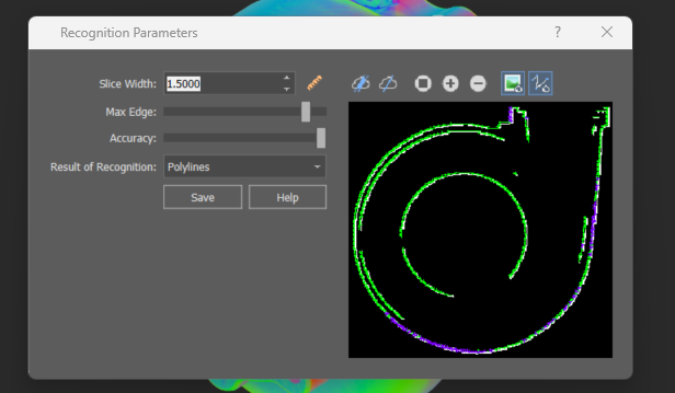
The foundation of nanoCAD 3DScan is built on fully automatic and automated algorithms that utilize methods of artificial intelligence, mathematical statistics, and computational geometry.
The parametric geometry recognized in this way forms the basis for a hybrid representation of:
The parametric geometry recognized in this way forms the basis for a hybrid representation of:
- Point Clouds
- "Smart" constraints (constraints to geometry not present in the drawing, defined by parameters of parametric elements recognized in the cloud)
- Dynamic user-defined coordinate systems (set by parameters of parametric elements recognized in the cloud)
- Automatic generation of vector models
Licensing
Choose a plan that meet your needs, or try nanoCAD 3DScan for free for 30 days
Choose Network or Workstation license.
For 1 or 3 years.
For 1 or 3 years.
nanoCAD 3DScan and nanoCAD Platform with all modules are available for free for 30 days.
Students and teachers can apply for free licenses.
Still have Questions?
Visit our Support Center to find the answers to all your questions
In the Learning Center you’ll find Video Tutorials, Test Drives and Articles about our products
Installation and registration
To get detailed instructions on how to install and register nanoCAD 3DScan, please read the Installation and Registration Guide or refer to the process in the How to install and register nanoCAD 3DScan section on the nanoCAD 3DScan Download page.
Licensing and Subscriptions
We provide subscriptions that run for either one year or three years. During the duration of the subscription, you receive free technical support and free upgrades.
With the one-year subscription, you can use nanoCAD 3DScan for one year, as well as receive, at no charge, all upgrades released during the year. After the year ends, the software stops working; to continue using it, renew the license.
The three-year subscription includes a perpetual license. You can use it forever. Technical support and upgrades to new versions are free during those three years, after which you can purchase a one- or three-year subscription to receive ongoing updates and technical support.
Workstation subscriptions run nanoCAD 3DScan on a single computer only. The license cannot be transferred to another computer.
Network subscription can be used to run nanoCAD on any computer connected to the local network, once the license server software (supplied) is installed. Licenses can be temporarily transferred to computers disconnected from the network, such as for working from home or going on business trips. For more information, please read our Installation and Registration Guide.
Network subscription can be used to run nanoCAD on any computer connected to the local network, once the license server software (supplied) is installed. Licenses can be temporarily transferred to computers disconnected from the network, such as for working from home or going on business trips. For more information, please read our Installation and Registration Guide.
No. The workstation license cannot be moved between computers. If your computer breaks down, or if you have purchased a new one, then please send an email to support@nanocad.com with the software serial number and a description of the issue. We will activate the license for your new computer.
To get detailed instructions on how to install, register and activate network license of nanoCAD 3DScan go to the nanoCAD 3DScan Donload page, in the How to install and register nanoCAD 3DScan section, click Commercial - Network opposite Choose type of License for nanoCAD 3DSCan the and follow the instructions.
Please contact nanoCAD technical support through e-mail at support@nanocad.com. We will make the change for you.
The permanent license of nanoCAD 3DScan lets you run the software in perpetuity. To obtain a permanent license, choose a three-year subscription on the shopping page. You will get the permanent license and three years of free updates and technical support.
This depends on the length of subscription you licensed:
In either case, you need to renew your subscription to continue receiving updates, and, in the case of one-year subscriptions, to keep using the software.
- One-year subscription - the program stops working at the end of the subscription period.
- Three-year subscription - the program continues to keep working after the three-year subscription ends.
In either case, you need to renew your subscription to continue receiving updates, and, in the case of one-year subscriptions, to keep using the software.
The three-year subscription includes three years of upgrades and technical support. If you wish to upgrade nanoCAD products to a new release once the subscription period ends, you should purchase another subscription, either for one year or for three.
Once your subscription expires, please follow these steps:
- Go to your Personal account in the nanoCAD 3DScan licenses section.
- Select the license you want to renew and click the Manage license button.
- In the Renew Subscription section, select appropriate period for renewing your subscription and click the Add to cart button.
- After making a purchase, your license will be renewed.
Start using nanoCAD 3DScan right now


 De
De  Es
Es  Fr
Fr  Pt
Pt 

